June 22 - We got up early, made our way through the campground and found the John Muir Trail. Everyone said it was all downhill, but the first 5 miles weren�t. Spent the day hiking the 27 miles to Yosemite Valley. Hiked past beautiful Unicorn Peak and later had beautiful views of Yosemite Valley from the vicinity of Nevada Falls. Didn�t climb Half Dome, saved it for another trip. Goslowgofar hiked in to meet us from Yosemite Valley and we met her just past the cut off trail to Half Dome. Finished the JMT at Yosemite Valley, then Goslowgofar took us for pizza and brought us back to Tuolumne Meadows. It was greatly appreciated, and we had a wonderful time.
June 23 - We spent the entire day hanging out at the picnic tables at Tuolumne Meadows. Hikers came and resupplied, and the post office was very busy helping us mail ice axes, surplus food and my Army blanket bag liner home. I elected to keep my ax until I got to Echo Lake out of respect for Rainmaker�s and Cindy Ross� experiences at Sonora Pass. I may be the only hiker carrying an ax through this section, but it also makes a good weapon. I hopped on a shuttle bus to get a $2 shower at Tuolumne Lodge. It was great �Zero Mile� day; spent the night at the walk-in Backpacker�s Campground.
June 24 - Ben (�Cobweb�) packed up and left at 5:18 this morning, saying �Bye, Brawny� as he left the campground. I am sad that we had to part, but he is determined to get to Ashland, OR, 800 miles away, by the end of July. I don�t need to get to Sonora Pass until July 12, only 74 miles away. Goslowgofar met me at Tuolumne Meadows about 10:00 a.m., and we hiked back to the PCT. She hiked with me to the campground at Glen Aulin, and returned to Tuolumne Meadows via a shortcut she knows about. It�s really been some great trail magic getting to spend these days with her and I enjoyed her stories about her thru-hike of the AT. She is very proud of her �back yard� (Yosemite Valley) and I can certainly see why. We parted company at Glen Aulin and I continued another 12 miles to McCabe Lake Trail junction. Because of bears, I buried my food under rocks between large boulders and gathered some smaller rocks to use as ammunition should the need arise. No sign of human camp is near, no fire rings, no human footprints or trash. Hope all this effort gives me a quiet night.
June 25 - What a treat to sleep as late as I wanted, have a hot breakfast, and piddle around to my heart�s content. Got on the trail at 7:30 and crossed a stream at Virginia Canyon. Met a young woman who was on a work trip, she and I have hiked together all day, and it has been a real pleasure. Hiked only about 10 miles and buried my food again; was a big job since my food fills 2 stuff sacks. The weather is partly cloudy and pleasant, though it does get chilly at night. I sleep with all my clothes on inside a tent in a 20 degree bag and I�m just barely making it concerning staying warm at night. The idea that a person sleeps warmer in less clothes has been proven to me to be a fallacy. My next sleeping bag will be a 0 degree bag.
June 26 - All food present and accounted for. Yosemite Valley and Tuolumne Meadows have served to split up the group that had been bunched together on the trail. Some young men opted to climb rocks down in the valley for a few days. Other hikers had family members meet them for a few well deserved days off. Hiking solo; forded several wide streams that are very low for this time of year. The climb up Benson Pass was ambiguous, if it hadn�t been for the rock ducks (markers), I don�t think I could have found my way. One important note; don�t ever cut switchbacks on a multi-use trail, you could very easily end up on a spur trail. Later, I crossed Kerrick Canyon Creek and cooked supper. Maybe it was the double hot chocolate and black licorish, but somehow the ramen and cheese delight didn�t go down very well. Or perhaps it was the dried apricots? Anyway, I felt ill. I didn�t want to camp where I�d cooked, but my stomach hurt. As I contemplated the situation, it was already after 5:00 with a 900 foot climb ahead of me and a steep descent on the other side. Suddenly, off to my left walked a beautiful black bear. I don�t believe he saw me, or perhaps he was just being nonchalant. Decision made; guess I can hike some more tonight. I put on my pack while watching the bushes the bear had gone into. I saw him cross the stream via some rocks like a human would do, and he dashed off. I believe he either caught my scent or saw me at that point. I hiked another 3 miles and camped among some boulders. Hiked a total of 19 miles.
June 27 - Unbelievable 25 mile day. I�m now camped in Kennedy Canyon, 11 miles from Sonora Pass. Very cloudy and cold, put on some major miles and haven�t seen a soul all day. Very lonely for a face; would like to see another human being. I saw 2 people fishing at Dorothy Lake, they watched me the entire time I skirted the east side of the lake. When I got there, I said hello, and they completely ignored me. A bit later, I met a park ranger on horseback, and I talked his ear off for a while. He mentioned he had seen a couple just ahead, and thinking that it was Gutsy and Dan, I was determined to catch up to them. I hiked like crazy, and had supper by the bridge on West Walker River. A man I saw camped just past there said that the couple was only 45 minutes ahead. At that point, it was 6:30 and I figured that they would camp by Kennedy Creek. I crossed the creek, and seeing a tent, I called out, �Gutsy? Dan?� It was Shady Tree, Nightingale and their dog. Another couple camped across the trail also fit the description, but turned out to be Barbara and Charlie. Finally, I�m camping with others again! If it ever gets warm, I have to get a bath. I have so many layers of dirt, I have no idea what color (how tan) I actually am.
June 28 - Had a leisurely breakfast, and almost forgot my hiking poles when I left Kennedy Canyon. Extremely windy walking on the 6 inch ledge that served as trail across the ridge. Needed to stop and put on my wind clothes and later had to negotiate an ice slope using my ax. Got to Sonora Pass about 3:30. Alexa came in, and we stealth camped in the same spot where Rainmaker camped in 1999, and he and I camped together last year.
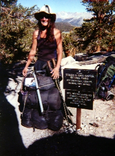
Kind of tired of burying my food and hiking alone, I lightened my pack, throwing out anything possible in the garbage cans at Sonora Pass. I hoped to do this next section in 4 days.
June 29 - This morning, before heading out, we met Ann, another woman soloists. Alexa and she agreed, Echo Lake in 3 days. What?? Thats 74 miles. By Sunday, yes, and this was Friday morning. Oh well...lets see what happens.
Crazy thru-hiker mode took over. We made 14 miles by lunch time at Boulder Creek. Hiked until dark, going down steep switchbacks past Noble Lake. Had a gorgeous sunset, and Alexa and I camped at the same spot Rainmaker and I camped last year. It is a beautiful little spot above a raging creek. Hiked 27 miles. Felt great, strong and happy to be "thru " hiking again.
June 30 � Did 28 miles today after getting on the trail at daylight and hiking until dark. The dreaded Blue Lake ridge walk (�The Nipple�) was done before supper. Strong winds, narrow trail and a steep 1,000 ft. dropoff made me remember with trepidation this stretch of trail. Alexa and Ann went ahead, planning a 31 mile day to get to Carson Pass. I camped atop a very windy ridge 4 miles from Carson Pass, tucked under a multi-trunk tree. I figured if it survived long enough to grow as big as it was(perhaps 18 feet tall), that surely it would survive one more night.
July 1 - Awoke to a beautiful sunrise; this is the reward of a high camp. Got to the ranger station at Carson Pass about 8:30, but found that the public phone was out of order because of some digging that was going on nearby. A volunteer at the ranger station gave me a quart of fresh Bing cherries in a zip-loc bag and a soda. Determined to make Echo Lake today and call home. A lot of trail markers are evident and it was easy to find my way. Reached Echo Lake about 5:30, some young trail friends saw me coming from a distance and gave me a peach, soda and chips. Called Rainmaker, and managed to get a ride to Berkeley Camp. For $10, I have a hot shower, access to a hot tub, and a bed in a shared tent cabin. I am done! I have 11 days until Rainmaker arrives, and I intend to spend the time resting and relaxing.
July 2 - July 13 were spent resting and recuperating near S. Lake Tahoe.
Crater Lake to Manning Park, Canada
July 14 - Rented a car at Reno Airport Friday, and drove up to Klamath Falls with Rainmaker. Our dear friends Brenda and Ralph picked us up, and took us to their home where we spent the night. Had this fantastic supper which Brenda cooked, Diane and Dan came over, too. So great seeing them again, trail friends and angels from last year. Today they brought us up to Crater Lake and also stashed water for us at Hwy. 138. To our surprise and delight they also stashed 2 giant Snickers bars for us.
Hiked 17 miles to our campsite just north of 138. The rim trail around Crater Lake was spectacular, although giving and taking the same 300 ft. of elevation. Once we rejoined the official PCT, the trail leveled out and we made good time, arriving in camp around 6, after a late start at 9 a.m. Very happy to be sharing a double wall tent with my partner Rainmaker. No more cold nights.
July 15 - Hiked about 12 miles. Its very cold for this time of year. This morning I couldn't seem to get warm, wearing gloves, balaclava, wind pants, two layers over my hiking clothes. Water so cold, it chilled us when we drank it. Picked up 4 qts. at Thielsen Creek and hiked to a saddle. Its getting cloudy and looks like rain. Or snow. Good heavens. July in southern Oregon.
July 16 - Hiked a very cold 12 miles from the saddle over to Tolo Camp. Water was a steep decent 1/3 mile down a spur trail at Tolo Spring. Rained a lot last night and our tent proved true. We each have a vestibule and made ourselves hot coffee and breakfast this morning before packing up and heading out. This 3 1/2 pound double wall Coleman Cobra tent kept us dry. Met a hiker who is from Oregon. He reassured us that this is unusual weather and would warm up sooner or later. Thank God. I was mentally preparing my muckloc order form.
July 17 - Awoke to clear skies, but still cold. Hiked up to Windigo Pass, then got on the original PCT route, now called Oldenburg River Trail. Lots of lakes on this route. Hiked 16 miles. The trail is well maintained, the seasonal creeks, though, were dry. Very few mosquitoes, our theory being they all froze to death the last 2 nights. Lots of horse droppings on trail, but Whitefish Horse Camp ahead doesn't allow campers Without horses. Maybe I should get a bridle. Plenty of water faucets there, though.
July 18 - Hiked 10 1/2 miles to Shelter Cove Resort. The store is expensive so we scrounged in a hiker box. I only needed 3 days food but should have bought something. I got some "soak and heat" stuff I will politely refer to as food, and dumped it in with my tad of remaining Ramen and mashed potatoes. This concoction would have worked had there not been all these little peas, inedible and dangerous seeds. Just bird feed, I kid you not. I called it Shit Supreme.
I dont want Rain to bail me, but he is passing me mashed potatoes and I gratefully accept them. Hiked out from the resort. NO post office really, just will accept packages, no stamps, but a stamp meter. They do have a phone.
We split a half gallon of vanilla ice cream, sprinkling on top hot cocoa mix to try for some interest.
Hiked another 4 miles out to camp.
July 19 - Hiked 14 miles to Charlton Lake. Picked all the dehydrated peas and beans out of my supper so I can cook the remaining food for tonight. Warmed up a little today, but clouded over. Thunder is causing us to prepare for rain again. Its so nice to share and have time with my partner Rainmaker.
July 20 - Hiked almost 15 miles. Still cold and partly cloudy, thundering much of the day. Small lakes and ponds abound, so do the hungry mosquitoes. 100% DEET is necessary for sanity. Earlier, a hiker was coming up behind us as we passed through a burned over section. We stepped off trail, and waited until he caught up. Much to my surprise and pleasure, it was Lightingbolt! Hadn't seen him since the kick-off party, April 28th. We took photos, introduced Rain to Lightingbolt, and got caught up on news. This guy is flying with 38 mile days. Met another thru-hiker, Jason, who has been leap frogging with Lighting and Erik Wiese. I asked them to give my regards to that fellow from Tennessee whom we will never catch. Ultralight is definitely the way to go with the long trail. Most of the weight is food, which is a pleasure to deplete on mega sections of 150+ miles.
July 21 - Hiked 13 miles plus one more into Elk Lake Resort. I was glad to be sitting at a table, warm and waiting for our friend who lives in Bend to come pick us up. Thankfully, she offered to help us, and we will resupply there. This resort has hot meals, which smell delicious. The few groceries here could not even resupply one thru hiker, if he or she could afford them.
Bought a beautiful fleece turtleneck in Bend. I am swapping that for the silk button down shirt. That silk layer worked great in the desert, allowing for warmth and ventilation, but now has deteriorated with the sun. The fleece turtleneck is so necessary now; vital in cold weather in keeping my neck warm.
July 23 - Monday, left Bend and got back on trail. We Hiked 6 miles to Camelot Lake, arriving around 8 p.m. That chocolate milkshake from McDonalds while driving over to the trailhead was one last treat, so refreshing. Its warmed up a lot and my extra clothes aren't really needed just now, but so glad I have them. My new Nike day and a half pack is really loaded with food and is heavy. Will have to do some adjustments, sewing and such tonight.
We set up the tent, I threw everything inside and sewed while munching goodies. Rain cooked outside. His ankle is of great concern to both of us. We will hike slowly these next days, in hopes of improvement. Never thought I'd see him hiking in Smart Wool socks and sandals. I have food for 10 days. Better to do ten 10's than to hurry and loose my partner. I would hate for him to get off the trail.
July 24 - Hiked 13 miles and have a beautiful site among obsidian rocks and mossy covered trees. Mosquitoes are lessening. Enjoying very pleasant temperatures. The scenery is the best yet, with flowers, small lakes and streams, mountains blue in the distance. Eight hikers have passed us, weekenders. We are hard to notice, stealthily camped above the trail. Only 2 saw us. I cut some blue pad from my closed cell to pad the hip belt on my fanny pack. There is only a thin belt we sewed on to my light 1500 cubic inch pack, the food weight is causing the belt to hurt. Hope this trail innovation helps.
July 25 - Hiked to Lava Camp Lake trail. Hauled water up to our camp. A relaxing day, the scenery so beautiful we stopped many times to just look around and marvel. A lot of lava flow through this section made the trail rough in places. Marvelous veiws of northern mountains and evergreens, white barked trees, and sweet smelling lupine all made this day's hiking perfect. Cloudless skies and moderate temperatures sweeten the delight.
Encountered 18 horses and riders though, who seem to have no regard for hikers. Even though we were on narrow ledges, they kept right on coming. I scrambled down hill to get out of their way far enough off trail to avoid kicks by startled horses. One horse was especially spooked and kept shying. I backed further and further away, talking softly to calm it. Finally it passed but then it had to totally circumvent Rainmaker, a man too scary looking for that horse to handle. That horse's name was Murphy. I guess with the idea, if anything can spook this horse, it will.
July 26 - 2,000 miles! Well, 1999.6 at this Lily Pad Pond which is just so lovely a campsite. Hiked over 16 miles today, through lava flow, rough terain. The cold spring was a 18" diameter hole in the ground, with water about a foot deep, just on the right side of the trail. We took our afternoon break there and decided to press for this lake. Its warm and sunny and I have plenty of food. So good.
Last night before bed, around 6:30, 3 thru hikers came past. They cooked supper at the junction down to the Lava Camp Lake and pressed on. While they cooked and ate, Rain and I kept them company and it was fun catching up on trail news. Seeing how this threesome got along so well, even to cooking and eating out of the same pot was a marvel. They share a 10 x 10 ft. tarp. The three amigos, but we later learned, not the three Original Amigos. Those we would later meet.
July 27 - Decided to hike thte lower Oregon Skyline Trail, which is an alternate old PCT route, lower in elevation and passing numerous lakes and streams. Many seasonal creeks are dried up and the new PCT route for the next 28 miles has only a few water sites available, some as much as a mile off trail.
Hiked for awhile with a man named Chad and his son Joseph. They are base camped and out on a day hike. We talked about trail desserts! Suddenly we heard the thudding of hooves, so stepped aside, and allowed 4 women with their 7 horses to pass. The 3 pack horses each loaded with huge plastic boxes on both flanks passed as we chatted with the women. They were heading to Red Butte Lake today, hauling in gear etc. for their class they will teach tomorow. The class? Leave no trace. All this for 12 people. I kid you not. They wanted to lighten the load of those coming tomorow. Its the greatest paradox. Horses and all that stuff. Leave no trace. Yeah. Tell me how you get one horse down the trail with no trace. How about 7, pounding, eating, defecating, horses hauling in god knows what, to teach 12 students how to leave no trace.
Hiked 15 miles today, camped near Marion Lake.
July 28 - Saturday, I realized this morning that I have been on the trail for 3 months. Woke up to rain and the realization that my hiking clothes were all wet. Had left them out under a starry sky last night to air out. We each cooked in our vestibules and packed up during a lull in the drizzle and a very cold day. At lunch we sat under out tent fly trying to stay warm. Hiked in 3 layers on top, shorts and rain pants. The sil-nylon is really doing its job and the mittens help my hands stay warm under the gloves. Hiked 14 miles, camped just above Milk Creek. The sun is shining intermittently now, and we have all our gear spread around drying. Contemplating a resupply at Ollalie Lake Resort. Reported to be similar to Shelter Cove, we dread the high prices and limited selection.
"Maybe they'll have some decent deals. Like Ramen, 2 for a dollar. Or, buy one oatmeal, get one free."
Rainmaker considers my banter, and I suggest, "Maybe like a free motel room with the purchase of every Ramen." Rain turns and gives me this incredulous look.
Have met 3 dads, with their young sons, and 2 couples, and a group of teenage boys, in the last 24 hours. Humm; women, whats up?
July 29 - Rain began about 8:30 this morning; a cold sleeting rain. We climbed from 4300 feet to 7010 amidst clouds and rain. Saw several other hikers, all wearing rain parkas and heavy clothes, pack covers or garbage bags covering their gear. 2 laden llamas, 3 boys and two men passed us. These small boys were hiking up over the mountain today and down to a lake. I felt sorry for them. When they stopped to chat, the llamas gave me withering looks, and leaned towards me. I kept backing off trail, wondering how far one could spit, and if they would break lose to bite me. LLamas with an Attitiude.
Hiked 13 miles, too cold to stop long, sliding down the snow covered slopes on the northside. I took some photos of Rainmaker crossing in his sandals and Smart Wool socks. Something wrong with this picture. Crossing snow, July 29, in Oregon. Now in a shelter at Breitenbush Lake, a welcome surprise. We sit at a wooden picnic table as the rain pelts the roof. Each of us has gone through several liters of water, rehydrating with warm fluids. Our rain fly is hanging to block the wind on the one open side of the shelter.
July 30 - We ended up setting up our tent in the shelter last night. Hiked 6 1/2 miles into Ollalie Lake Resort. They have adequate food stuff, but expensive. A microwave is available so I made some popcorn. Hot coffee, and hot water is available. Ramen is 75 cents. A rustic cabin rents for $60; a 30 minute shower is $5. One at a time, please. There are bagels, muffins and pastries for a buck each. One generous man who was hiking and leaving tomorrow gave us a lot of his extra food. This helped enormously. Met Paul, another thru hiker, and The Three original Amigos there. Hiked out another 4 miles, and camped by Lake Jude.
I am amazed by how much food I eat lately, but its been so cold, and staying warm requires calories.
July 31 - Hiked 15 miles today. Woke up to mostly blue skies, a welcome surprise. The forcast had told us at least 2 more days of rain remained. Few mosquitoes left. Saw my first glimpse of Mt. Hood. Truly magnificent glaciers and clouds around it.
At lunch we spread out gear in the sunshine. I am drying socks on my pack, and swapping them every few hours for those on my feet. I hope to hasten the drying of my shoes this way, kinda an internal mopping. Rainmaker's sandals are dry, and his socks are doing nicely, also. Humm, interesting concept.
Camped by a spring 2 miles before Warm Spring River.
August 1 - Hiked 15 miles, and camped in a sweet little site right next to Timothy Lake.
Met a lot of week-enders, hikers out with packs for a few days. Answered questions about when we started, gear, etc. Trying to get information about Government Camp, our next resupply 17 miles away. Really looking forward to pancakes and hot coffee.
One hiker gave us such a laugh, running out of water, walking along Timothy Lake. He told Rainmaker he didn't want to drink water out of a lake, because of the boats in it. I should give him a clue. This water is great. Wait til he has to wade through cow droppings to pick up water.
Rainmaker and some birds are having a contest over his food. I give you one guess who will win. We are not benevolent day or week hikers. We are hungry long distance hikers used to defending our food and winning.
August 2 - Hiked about 17 miles, camped .2 miles from Hwy. 35. Going into Government Camp tommorow early enough for a pancake breakfast. I'm really tired tonight, not exactly sure why. I think perhaps dehydrated, and wishing I had something sweet to eat. Saw some beautiful views of Mt. Hood, grand in its ruggedness. We've been 11 nights on the trail since Bend.
August 3 - This morning we packed up camp after a brief breakfast of coffee and the tad of food remaining. Walked up to Hwy. 35 where we got a ride with the first car that came by - a snowboarder bound for Timberline Lodge, the glacier and snow that offer summer fun.
This town, Government Camp, is something else. At the Huckleberry Inn we ordered breakfast and drank coffee to our hearts content. Rented a bunk room for $84 which was pricey but with rain moving in we were glad to have it. There are 6 beds here, 3 sets of bunks, so we just spread the gear all over the place, sorting and resupplying. A TV with 10 stations, a phone, wonderful tub and shower is just heaven. A laundromat is next door. The village store has a lot to offer, and prices the best I've seen outside of a hiker box. Went to the post office just a block down the road. A very good town stay if you have someone to split the motel price with. Food is great, a snowboarders convention center, seemingly, with test areas and kids with boards all over town. All the gear shops wax boards, sell clothing, and accessories. No hiker gear. All snow gear. I cruised every shop in town looking for a serious hip belt. No luck. Not even close.
Across the street live music will play in a bar. This is a real happening place.
August 4 - Left our room just before 11 a.m. check out time. Hiked out in the fog and drizzle and back on trail by 11:38. A woman who'd been doing a section hike and just got off saw us and gave us a ride, a pint of raspberries and offered any food we needed of her supplies.
Hiked 5 miles to Timberline Lodge. Had pizza and chef's salad there for David's(Rainmaker) belated birthday meal. There are 5 dining areas in that location, but one was being used for a wedding reception and two were closed. The fancy bar upstairs was available, but we opted for the Blue Ox, located on the bottom floor. A cute little cozy place, nestled in a corner. Great Starbucks coffee. Male Waiters!
Hiked another 4.6 miles to Lost Creek and what was one time Paradise Park Shelter. It is now a pile of rocks. 45 miles to Cascade Locks and the Oregon border. Very cold tonight. Met some nice women who gave us Bing cherries. Yummy. Ate those with the leftover pizza. Have all my clothes on, in the tent. Just barely warm enough.
August 5 - Saw so many day hikers, their kids and their dogs. Hiked 15 miles, some tough uphill on the new PCT route because the old one up to Bald Mt. is full of mud slides and trashed trail. A posted sign said it wasn't worth maintaining anymore, but hikers, not horses, could still use the old one.
The black flies are maddening, having no respect for numerous applications of DEET. Yet, I continue applying it with hopes it will keep them at bay.
Picked up water at a trickling spring just .4 north of Lolo Pass Rd. Hiked about a mile until we finally found a campsite just off trail on the right side. On the left is a notice posted every 200 yards telling of a 6 month jail sentence and $5,000 fine if caught camping there, because of the Bull Run Watershed Act.
If any topic can get me going its Leave No Trace aimed at hikers, but allowing cattle and horses through here at all. We leave no trace, cut no vegetation, bury personal waste, carry out all traces. But cattle, for the financial benefit of a few are allowed to totally trash around on our national lands and wildernesses for a pittance of money, some of which ranchers haven't even paid for 5 years. We are told to cut no switchbacks, a very reasonable request, and herds of cattle are grazed in our wilderness, tromping and tearing up the hard work of maintainers. It really gets to me sometimes. Poisoning our water with their waste.
Oh well. A perfect hiking day, with magnificent views of Mt Hood. Warm and breezy at times. We did 15 miles.
August 6 - Hiked about 14.5 miles and camped near a waterfall on the Eagle Creek alternate route, suggested by the guide book, and everyone who has ever hiked it.
The morning was the warmest its been since Crater Lake. Hiked through lots of raspberry, thimbleberries and huckleberies. At lower elevations the berries are ripe. We have been enjoying the berries alot. The vegetation covers the trail in many areas, making it hard to see the rocks below. Great views then opened up of the Columbia River Gorge, and northerly views of Mt. St. Helens, Rainer and Mt. Adams.
Met a couple today southbound. They have 1100 miles to Sonora Pass, I realized later. Wonder what that'd be like in October.
A trail mix of pretzels, crushed a bit, Fritos, and chocolate chips is pretty decent.
August 7 - Tuesday. We heard there was free camping for PCT hikers at the RV Marine Campground 1/4 miles east of town, so that was our goal for today.
We got on the trail by a normal 7:30 a.m. after hot steaming coffee and cream cheese on a bagel. Strolling along past waterfalls, ahead of Rainmaker, both of us were enjoying the ripe thimbleberries along the edge of the trail.
I rounded one curve and thought I heard some noises down in a small canyon, thinking it was people and what on earth were they doing down there. The trail was narrow ledge, dropping off into the canyon, the wall rising straight up on my left. I continued munching trailside berries, rounded a bend, when suddenly heard something going swish by my right sholder. I thought something had brushed my pack and turned to look.
Glancing back, I saw a black shape just next to the tree at the trail's edge. "David, a bear!" I looked up, and saw her cub in the tree that was so close I could touch it.
I began backing up, clicking my hiking poles together as a million thoughts raced through my mind. What on earth? Is that a bear? How on earth did I not see her? Oh my god, I just walked right past a mother bear and cub.
Not wanting David to walk past her as I did, I called several times, David, a bear!
She raised up, looking very angry and began to huff and woof at me. I kept backing up, looking behind at the trail so I wouldn't fall off it, hoping also that I wasn't backing into another bear. I couldn't yell, I have no idea why not, but just kept watching as I anticipated her bluff charge. A bluff charge, I asked myself? Is there any room for a bluff charge? All my senses getting ready for it, and determined not to run.
Rainmaker (David) around the bend, was calling to me, "Carol, don't run! don't run." Because of the waterfall we couldn't hear each other, and had no idea what the other was doing. He had seen the cub scurry up the tree, and knew I was just up ahead. He kept advancing on the mother bear, yelling to me, hoping I could hear, hoping she would become confused, perhaps be distracted, and even turn her attention to him.
Finally, she dropped on all fours, and ran off down into the canyon. Her cub soon followed. Then, Rainmaker came around the bend.
We held each other close for awhile, reliving it, telling our experiences over and over. I have never had anyone risk their life for me before. I don't think I ever had anyone who was willing to.
Its something I will never forget.
Safe and sound we continued on the Eagle Creek Trail, a marvelous section which brings one past Tunnel Falls, and unpaintable beauty. There is cable embedded on the canyon walls for hand holds. It is a popular trail as one gets within 5 miles of Cascade Locks.
By 3:30 we were in town, camping by 4:30.
Cascade Locks has restaurants a plenty. I plan to check them out soon.
August 8 - I can't sleep, ate too much taco salad, a wonderful meal for two, served to one in a huge, deep fried tortilla shell with taco chips on the side.
Then, there's the quarterly hour Special, a freight train roaring past shaking the ground to pieces, me included. Aha, that would be the 6 strands of rails we crossed just before this campsite designated for PCT hikers. No wonder they give it free.
Maybe I've seen Green Fried Tomatoes too many times. Maybe I'm also still wound up from yesterday's bear encounter. That was a trail gift, to see bears so close. Anyways, here I sit in the well lit public bathroom, on a bench, writing and drinking water at 2 a.m. Could be worse. Lots worse.
Later that day:
Packed up at the visiter center free site and checked into the Econo Lodge next to the restaurant, across from the mini-mart, an ice cream shop and the post office. Had a zero hiking day, but still was very busy with bounce boxes, resupplying and fantastic gift packages sent by friends. Rain went to the library to use their computer and was able to get online for 1/2 hour (the limit). Did laundry, wrote letters, met Cindy, another long distance PCT hiker. Gave Rain a haircut, now he doesn't look quite so wild.
August9 - Packed up and left by 10 a.m. Walked across Bridge of the Gods for free (a courtesy to thru hikers). We opted for the alternate route to Stevenson, Washington and continued up to Carson, about 8 miles. Extremely hot and dry, but fun eating at the mini-mart just as one enters Stevenson. Now camped at a motel/RV park, where the owner is refurbishing an apartment. He is letting us use that bathroom, the kitchen with complete facilities, plus a place to camp, for only $10.
Across the street is a good sized grocery store, a definite resupply option.
The post office is next to it. Had we know these facts, we would have used it instead of Cascade Locks, and avoided carrying food these last miles. ATM machine available here, also.
Write it down in detail
Visualize having it
Devise plan
Say no to anything that gets in the way
---from Jim Walters' (note on the TV set)I love it.
August 10 - Hiked up to Panther Creek Rd. and hit the PCT by 10 a.m. Hauled water to make the 2,500 ft. climb. Dropped down 350 ft. to camp next to Cedar Creek. I have my pack so heavy, it was so hot, sweat was dripping off my face. Took a bath downstream at camp and feel tons better. A small wooden sign at the top of the trail tells of this camp. Now only 104 miles from White Pass.
August 11 - Hiked 15 miles and camped near trail between Blue Lakes and Lake Sebago. A young couple is camped next to us. They came about an hour after we set up. They have a dog, which they allowed to roam all over our camp, saying, "Just let us know if he is bothering you."
Rain and I just returned that statement with an unsmiling stare. They got the message and tied up their dog.
Very crowded camping, its Saturday, that's right!
August 12 - Hiked 16 miles today to camp by Steamboat Lake, .2 mile off trail. It was warm again, with flies and mosquitoes. I know this won't last long, only 425 miles from Canada, with summer closing fast.
I have thought every thought over at least 4 to 5 times. I am running out of thoughts. I have redesigned my pack, designed new tents, clothes, etc . I asked Rain and he said he is humming some tunes. Been a long time since I heard any tunes, but will hum what I can.
Today while hiking there were a lot of frogs on trail. One even jumped out in frount of me, hitting my pole, and bouncing off. Then he hopped away. A hit and run frog. Oughta be a law.
August 13 - Hiked 15 miles, camping just below Mt. Adams in a lovely spot.
Crossed Hwy. 88, which is a possible hitch into Trout Lake, but there was no traffic heard. Then crossed Hwy. 23, much more traffic. That would be a better option if one chose to get off the trail here. Just past that road, a woman had left a cooler with trail magic treats inside. That was such a lift to my spirit, very special. Thanks, Tripod.
We left there crossing several water sources, and met three people coming towards us. A man in white shirt (how strange) carrying topo maps. He stopped us, and asked me, "Do you know of any place these folks (the couple with him, he indicated with a gesture) could camp with water? Is there any water ahead?"
They had asked Rainmaker for spare water. There is a spring just ahead of us, we were counting on. When asked, they said it was dry. We showed them on the topo map the one we meant. "No, its dry. There is no water in this whole stretch."
I was unbelieving, just couldn't imagine. I told them of the water we'd passed, not to worry, that although we had none with us now to spare, they would surely have water to drink soon.
Rain and I hiked about 15 minutes and heard distinctly the flowing spring on our right, exactly where it was supposed to be. Minutes later, we came upon several campsites, with definite trails leading downward. Obvious signs of water. Following one down, there was a large spring, flowing happily along, with all the water and flowers one could wish for.
These people brought themselves out here without the ability to find water. Very dangerous. Listening, quietness, and observation, will get you what you need out here, generally speaking.
August 14 - Met Berkley Bill again, while we were having breakfast in camp. He is a thru-hiker I'd met in the Sierras. Rainmaker and I speak of the Donner Syndrome. Had they crossed that pass before they camped, they would have made California safe and avoided the dreaded winter, starvation, and resulting cannibalism.
With that in mind, we teased each other, next person who passes us early in the morning, while we eat breakfast, when they say, "have a nice breakfast" we would reply, "No, you Are breakfast!"
Man alive, trail humor!
Hiked 15 miles, crossing various glacier fed streams. The last, Muddy Fork, was icy cold and deep, the bridge being out. This was a barefoot crossing for me, Rain crossed first, in shoes, and as he neared the middle, suddenly stepped into a lower spot. The water, so strong and swift, nearly knocked him off his feet. I knew it would be almost to my hips.
I entered the flow, and was shocked by the cold. Concentrating, one firm step at a time. Rain set down his pack, and reentered the stream, to steady me as I hit that low spot, nearly losing my balance. Deep and icy, just below my hips.
Pack is definitely lighter with 2 1/2 days of food left for White Pass, 43 miles away. A man in a red pickup drove past, then returned to talk and evaluated us, as we camped just past a road. I dont think he'd seen Rainmaker the first time past, and he returned to investigate. After Rain talked with him, I felt a little better, but bad vibes from this guy kept me alert and nervous all night.
August 15 - Hiked 14 miles, went down spur trail 101 to camp by small lakes just 1/4 mile off PCT. Today saw a large brown colored Black bear, it ran away. Last night the bugleing of a bull elk,yipping of coyotes and fresh bear dropping in the morning made our own wilderness experience richer. We crossed a road, the last until White Pass, over 40 miles away. My energy is good, eating light is probably helping. Tomorrow looks to be a big day.
August 16 - A very frustrating day. A lot of climbing, beautiful views, but somehow just took a long time. We reached the Packwood Glacier, tried crossing it, and got 1/2 way when Rain said to turn back. All along, it had been iffy. As I crossed ahead of Rain, about 4 in the afternoon, I kept hearing noises from above. The glacier above me seemed to be groaning, shifting,or something. I glanced back at my partner, just in time to see a rock slide come down, barely missing him. I think thats when he had enough.
An alternate route, up over Old Snowy, was the only other option. My whole body screamed against the injustice of having to climb, when the data sheet said we were done with that for the day. The treadway down from Old Snowy was loose scree, and then began the undulations of the crest walk, as fog rolled in. No water until we got down from there, past Elk Pass. It would have been absolutely gorgeous had it not turned cold and windy, with night pressing us.
Finally, with partial views opening through the fog of high mountains and deep valleys, the trail descended and we camped near glacier melt streams in a sweet campsite above 6600 ft. Cookies, a granola bar and milk for supper, then conked out by dark. 14 miles, I guess.
August 17 - Hiked into White Pass using chairlift trail 1112. That was a mistake! Either we missed it, and missed the road down, or this option is nuts.
Once we reached the highway at White Pass, David lost no time in asking point blank some tourists if they would give us a ride to Packwood, 20 miles west along Hwy 12. They readily agreed, since they were going that way and off we went. Whew!
Packwood is a marvelous little town, with many motels, resturants, mini marts and laundry facilities. We reserved 2 nights at Hotel Packwood, a historic building with small quaint rooms. The bathroom, however, is down the hall. The owners keep coffee brewing all day, movie videos are available in the lounging area, and there are TV's and phones in the rooms. We paid $39 a night, and that was a weekend rate.
August 19 - Left Packwood today. We checked out of our room at 11:15, walked to the mini-mart, and ate some snacks. Got some shoe glue yesterday and sealed up some boot seams. Hope that helps these Faded Glory high-tops make the last few hundred miles. I have had them since Mojave, and thats pretty good. (They ended up lasting the entire rest of the trip, giving me over 1400 miles of service).
I have learned that ultralighting means saving pain, as in not carrying too many supplies like lotions and spare this and that. I am no pack mule. Most of my weight is food, and then clothes. Its turned cool and every piece I have I use.
In Packwood, the weather forecast was for 4 days of record cold and record rainfall. The upside of this is it will help the firefighters, and very welcome. The downside is we will have to be extremely careful of our gear, to be wet is to be cold, in elevations over 6,000 ft. Some hikers have decided to take a few extra days, and wait until it improves.
White Pass, where the PCT crosses the highway, has a mini-mart sort of place. Its called One Stop, not Kracker Barrel like the data sheet says. Nice folks there, with post office drops available, laundry and lodging of sorts. They sell some delicious corn dogs. Hiked out 6 miles and camped at Busch Lake.
August 20 - Monday. Last night I got sick, nauseated, my stomach felt like it had too much acid. Took an Immodium after midnight dig and release. Never leave home without 'em. Nibbling on pretzels with Advil.
Re-met Marny and Tom, hikers I'd met by Baden-Powell in the desert. I will remember Tom as the guy singing "Home, Home on the Range" while going through snow and trying to find the switchbacks up and over. Camped near side of trail above Two Lakes Trail. Skywalker came by; we chatted and gave him the weather forcast. He is beating it to Snoqualmie.
As we washed up from supper, I stood looking south, Rain's back against his pack, looking north. What was this face I saw looking back at me, from the log at trail's edge, not 30 feet from us? Was it a mule? A horse? an ugly hiker? The mind searched to place it...."David, there's a bear" When I spoke, it startled, and ran headlong downward, as fast as possible. It must have come to investigate some color or odor. That's 7 bears so far.
Rainmaker is in a lot of pain with his neck and back. With storm clouds approaching, we plan our strategy for the next stretch. Above all, keep the sleeping bag dry. We'll make it. Seems like the trail is always asking us, testing us, "How badly do you really want this?"
August 21 - Learned this morning that rocks make poor pot supports in cold weather. They seem to soak up all the heat my hex tablets put forth, paper and twigs don't help. Tent stakes tonight proved very workable, in spite of rainy weather.
Rainmaker and I have this ongoing study of ultralight technique. I provide the experimentation. He provides the astute observation. Even though he isn't an ultralighter, he does have the best and lightest stove system going, which I will adopt for the AT this spring.
Hiked a mere 12 miles in the promised rain and cold. Not nearly as cold as I'd figured, but its coming. Set up under some huge pines near Sheep Lake, the ground was sheltered enough to be dry. We both are enjoying hot coffee, all gear inside. Loving this tent with its two side doors and vestibules. Whoever designed this Colman tent for two was a genious. It adds at least 15 degrees of warmth once it is closed and we are in it for a bit. Weighs just 3 pounds, 11 ounces.
August 22 -
Hiked 15 miles through freezing rain and wind along open crest slopes. Pulled into camp early because breaks and lunch were so short, just grabbing a bite to eat. Camped by Arch Rock Springs, data sheet and guide book saying there's supposed to be a shelter here, but it burned down and was disassembled a couple of years ago.
Saw Miracle Mike tonight when he came down for water. Kam is still with him, though she waited at the top of the trail.
August 23 - Woke to blue skies! Hiked 5 miles to Urich Shelter, in Government Meadows, and enjoyed coffee on the wood stove. John and Cyclone were there, hanging out. On and off, sunny skies would appear, then it would rain, sometimes simultaneously. We needed to make 5 more miles to camp just south of the 14.4 waterless stretch. Rainmaker's back is in a precarious state. We will do shorter days and not carry water. I want to finish with him in Canada, so I will do whatever he decides, willingly. We discussed options. If he should need to leave the trail for two weeks' healing, would I continue without him, or wait out those two weeks? What if he couldn't return then? Finally decided I would need to go on. That not looking like much fun, we will be cautious, and take it one day at a time.
Tonight we set up camp just before another deluge started. I couldn't get my stakes into the rocky ground anywhere, to serve as a pot support. In desperation I used the metal ends of my hiking poles, while my partner laughed good naturedly in disbelief. "Is that rubber I smell burning?" he asked.
"Yeah, its the snow basket gaskets," I replied.
August 24 - 4th day of rain, clouds, drizzle and cold, finally broke clear this afternoon. Hiked 14.4 miles through beautiful forest, clear cuts, crossing several roads. Just before Tacoma Pass there was a bucket with cold sodas and treats a trail angel had placed there. His name is Mountain Dew, he thru-hiked the AT in 98.
August 25 - Woke to clear, cold skies; hiked 14 miles. What an unusual day. Just past Snowshoe Butte we met two people who forewarned us of a 100 mile race to take place on the PCT and nearby trails. Later that day it warmed up, and we looked for the water one-tenth mile west of the weather station access road. Couldn't be found. Berry pickers up on the hill gave us directions to a camp with water. Could not be found. Bummed and thirsty, we headed north, hoping seasonal rills would be running. Just at Road 54, Lizard Lake junction, was a group of men and women sitting around trucks and tables laden with food. We crossed that parking lot; they offered us water and asked about our welfare. Finding that we were PCT long distance hikers, they said "Get you a plate and help yourselves. We are the aid station at mile 35 for the 100 mile race."
We ate all that our dignity would allow. One man saw our reluctance and brought out the makings for sandwhiches, while another poured us Gatorade. "Don't worry," he said, "there's plenty. We'd be daresant to run out." A woman gave us snacks, and showed us fruit. So wonderful. Christmas in August!
Needing to make some more miles, we thanked them and headed out. Camped by Strip Creek in a tiny campsite next to the trail. Runners began passing us now, calling out things as they passed: "Are you hiking the PCT?" to which Rain answered after they were out of earshot..."No, we're waiting for the $%@&^ mall to open so we can go shopping!"
"Is this the right trail?" ....no, you took the wrong turn 50 miles back
"How ya doing?" audibly Rain responded "Fine, and you?" He claimed to be fine also, to which I called out (when he was out of range) "Liar!"
"40 done, 60 to go!" ....Rainmaker responds with 2400 done, 250 to go.
Seriously, there was a measure of extremism here, that we shared with them.
****Sung to "Leavin' on a Jet Plane":****
Instant coffee's made, its early morn
Poptarts ready, wrappers torn,
I hate to pack it up, and hit the trail
But, I'm leaving on a jet plane
Won't be back to this trail again
Oh Rain, its good to go.
So many snakes I've walked around
So many times I've nearly drowned
I tell you now, they don't mean a thing
All the bears we've met, there's been a few
All the resupplies, me and you
When we get back, those things will be online,
Cause, I'm leaving on a jet plane...
The deserts done, Sierras too
Trinities, Sisters, Cascades are through
Don't mean to brag, but thats the way it is
Every quart I carried, every pound of food
Every laugh and smile, every dark mood
I tell you now, that means everything
I'm leaving On a jet plane,
God, it'll be good to be home again
Oh Rain, its time to go.
August 26 & 27 - We arrived in Snoqualmie, another ski run descent into a cute little resort type town.
To my utter amazement, Ben (Cobweb) met us today, on trail! He stayed and finished instead of getting off in Ashland. So wonderful having my trail friends catching up to us, and exchanging news, views, and irreplacable smiles.
Nothing like it, at all, on this earth, the friendship and understanding, the crude jokes and laughter that long distance hiking brings. I love it.
We talk of the water in northern California, solutions to the cattle (a .357 Magnum, I believe was mentioned) We ask about the welfare of hikers ahead and behind. Trade incredible stories, of animals, hardships, sickness, and plummeting down 59 cut switchbacks. Naughty!!!
Supposedly there is a hiker friendly bed and breakfast in this town, simply call the number listed in the town guide. We wanted to. Believe me. Tried and tried. A ranger told us good luck. Probably on line. Well, it was a mile away, or so, and no one wanted to hike down there, to see if there was room. The Best Western gave us PCT special rates. A room normally going for $109 was rented to us for $65 a night. Hot tub, TV, private bath, with restaruant attached. I'm home. Anyone able to call that other place and get through deserves an award:
Most Persistant Hiker on the PCT. At least 6 hikers gave up during those two days we were there.
Resupplied out of the store, but that same sickness, nausea, and diarrhea from last week found me again. I am laying in bed, and bemoaning the delicious food I can't eat during this town stop.
August 28 - I'm very excited and happy about leaving Snoqualmie, bound for Skykomish and the Canadian border. I have been on the trail 4 months now. I think nastalgia will soon set in. We mailed a box ahead to Stehekin, 89 trail miles from the border. Seeing that resupply would be limited, we included pretzels, M&M'ss, Ramen and rice.
I'm feeling better now. Ate a good breakfast. Whatever this ailment is, it has the decency to last only 24 hours and allow me to eat small amounts.
Climbed 2,400 feet and camped by Grand Lake. Its beautiful and very rugged.
August 29 - Hiked through beautiful country today. I suppose its been beautiful this whole time. Just couldn't see it for all the fog and rain. Up and over Hucklberry Mt. was harder than I'd imagined, over to Park Lake. The trail was narrow scree, some chutes the guidebook talks about would be truely treacherous on ice or snow. As it was, only snow was way off on a mountain. Mosquitoes are still here! Glad I still have DEET for night and early morning in camp.
Camped at a beauful site by Lemah Creek, hiked 15 miles. Heard the cry of an eagle or hawk a lot today while climbing. Realized how special it was to be out here.
Up in the heights I walk the ridge,
Look way down below, I see the bridge
I crossed that log this early morning
In spite of all dayhiker warnings
Wind through my hair, an eagle cries
I'll soon be there,
Never be tame again
August 30 - Camped near Waptus Creek, just after crossing the bridge. Up trail there are great sites, and an older hiker is camped there. He talked with us while enjoying his one drink. "As long as I get only one, its going to be 100 proof Vodka," he stated.
Grizzly and Starman passed us today and I enjoyed, once again, trading news. We each are traveling newspapers. Lovely weather continues, as we look at nearing Canada in September, we take good weather as trail gifts. Rain and I only have 2 resupplies left, but our food options for the trail continue to dwindle because of nausea and just boredom / intense distaste for typical suppplies. The mere mention of peanut butter and pop tarts bring such a pitiful look to Rain's eyes that I agreed they are off limits. I won't eat Ramen, he won't eat dairy products. A couple of good loaves of bread, heavy as they are, will be our main stay.
August 31 - Hiked 15.5 miles today. The daily climb of over 2,000 ft. and corresponding descent makes me feel the profile map now. Now I understand why this section's profile looks like tines on a fork.
Last night, after two extra strength Tylenol, I woke with a start. Earlier, Rain had mentioned something about "some damn mouse" ran across his arm. Yawn, yeah, ok. Passed out quietly. Suddenly though it was real, as I sat up quickly at 2 a.m. and said, "A Mouse!!". It seemed as though one had just ran past my head.
Like a cougar, Rain all at once, in 3 seconds, had the flashlight on, tracked that mouse, located him next to his Therma Rest and beat it to death with his fist. He then unzipped the door and flung his sorry hide outside. Zipped it up and laid back down. Heavens! So that's how it's done!
That mouse had chewed a hole through the mesh, dropped down onto my food bag, and musta been one dense critter, because he ran up to our heads to see if we were awake. Now he is smashed flatter than an ultralighters sleeping bag. If I had been him, I'd have munched myself sick, then made a break for it first light.
Sewed up the hole this evening, and fondly think of Rainmaker as the Avenger and Mortal Mouse Enemy. Probably got its roots from his AT thru hike in 92, when he trapped and killed 6 one evening, even helping to hang one by its neck with dental floss until life left its body. May it rest in peace in some cat body. Seriously, I don't really like mice.
Tucked in a cozy little campsite just before the headwaters of Cle Elum.
September 1 - Woke with rain pattering on our tent, snapping noise and such. I sleepily said, "David, I keep hearing stuff outside."
He replied thoughtfully, "Well, there's alot of stuff out there. Stands to reason."
I looked over at him. He was dead serious.
We made coffee, ate some rice crispy bars and packed up. Hiking on days like this you really don't take breaks other than to drink, pee and grab a bite. If you stop long you get cold. If you try to talk, the various layers make hearing all but impossible. He might ask, "Are you doing alright" and I would hear, through my hair, balclava, and rainhood, "Grrrrr, sit type." "Hunh?" I ask increduously.
He looks at me. Frowns. Repeats, "Are you cold, you want to stop?" I hear," Grrrr, old rotten pop." "What?" Can't hear anything.
All you want to do is get to camp, set up the tent, fling everything inside, and eat.
Keep things separated. The wet outside with the wet.
Dry inside with the dry, wearing it, eating it, or writing on it.
That's rainy day strategy.
Hiked 15 miles. Camped by Hope Lake, 8 miles out of Skykomish.
Septmeber 2 - Hiked 8 miles into Sevens Pass, and finlly got a ride down to Skykomish. One thing I've noticed. Its never the people with the nice cars, money or space who give hikers a ride. Its invariably someone with an old car, having to move bags, dogs, and themselves over to make room. May all their kindness return to them a hundredfold. May gifts come their way, and sunshine be their portion. Those pushing a brand new two-ton vehicle through life, usually solo, may they need a ride someday, and stand hoping.
This is one dying town. Only one motel remains in business. $73 for a tinsy room is high. Yet, it does have a microwave and small refrigerator, coffee pot and lots of channels on TV. The owner has been voted politician of the year. No laundry facilities. No, they couldn't let us use the washing machine for our wet and muddy gear. Ask a local. Hunh?
Fine. I washed everything out in the tub, hanging it to dry all around our room. He thought a load of wash would be hard on his septic tank. How about 2 bathtubs of hot water to wash with, and a couple more for wrinsing? We left with cleaner clothes. Its all relative. We have a saying, Rainmaker and I.
Its not actual dirt unless its real shit. I mean that literally.
Everything seems to be closed, or for sale. The deli is for sale. The one restaurant is for sale. They keep whatever hours that suit them. When I complained to another hiker that they closed unexpectedly at 2:00 one afternoon, he replied, "Well, then, you were lucky!"
The Chevron mini-mart, though, has sufficent food for a good resupply, and food we cooked in our motel. Baked potatoes, Sloppy Joes, and plenty of onions made a great meal.
All said, Levenworth, 36 miles east, would be a better town stop than this had been. Next time I will know.
September 4 - Hiked 10 miles after leaving town. There was supposed to be Janus Cabin Shelter here, but like the rest, has gone the way of the grave. I have the 2000 guide book, Rainmaker has the newer one. Supposed to be partly cloudy and clear this next week, no rain. Hope they are right. Manning Park only 171 miles away. Feeling very close and very cold. Fog rolling in, happy anticipation as we near our journey's end. I've loved this experience, but ready to go home for the winter.
September 5 - Hiked 14.5 miles, and camped by Pass Creek at a good site. Saw Meadow Ed today.
Well, it rained last night, cloudy and foggy all day, sometimes visibility is only a hundred feet or so. We know the mountains make their own weather, but wishing for some sun soon.
Rainmaker has his fleece bag liner now. I am glad, because I know how much I have needed mine and it makes me feel better knowing he will be warmer.
Last night some critter stole two wads of my toilet paper I keep in my shoe just outside my door, for night trips. Man alive, there's not an endless supply! Guess I will have to start sleeping with it!
September 6 - Hiked over 16 miles. Had a short period of sunshine, then fog rolled in. We weren't going to do Red Pass tonight, but remembering the Donner Party's folly in not doing the pass that evening, and getting snowed in, we elected to go for it. Camped 1.7 miles below, at 5,500 feet. Less elevation means warmer. This section of trail is like the last. A good climb every 10 miles or so, then dropping back into the valley. We can see our breath in the tent, wind chill must be hovering around 20 degrees.
September 7- Went over Fire Creek Pass today around 5:00 p.m. I believe this to be the most lovely place on the entire PCT. It was certainly my favorite. The evening sunshine brought out the golden hues of the fall colors. The grade was gentle, the mood sublime. A perfect contentment. We stopped and took several photos, all the while knowing it would never suffice. Hiked down to Mica Lake and camped by its sandy shore. We did 16 miles.
September 8 - Hiked only 13.5 miles. The climb this morning was overgrown and took alot of energy. Met Jason and his girlfriend Hana today, a great couple doing the state of Washington. The day was totally clear with beautiful blue skies. Somehow our bodies disagreed with the data sheet. 59 switchbacks down to Vista Creek. This took alot of time. Also, the old growth forest, survival trees, and nurse logs all deserved admiration. 5 others came to camp near us, John, Cyclone, Sara, Robin, Max and Spider. Stayed up past dark enjoying the comradeship.
September 9 - Miles came easier today. Rainmaker's opinion is that the data sheet was wrong yesterday, and now making up for it today. Only one climb of 3,000 ft. Need to make Stehekin before the bakery closes tomorow.
September 10 - Hiked 12 miles and caught the 3:00 p.m. bus. For $6 you get to ride into Stehekin. A difficult hitch. Met The Wolfpack, a man and his grown sons, also going into town.
The bus driver was friendly, but allowed too much time, getting us into town late, and barely missing the post office. David importuned the post man to stay open, and we were able to retrieve our box.
Lots of hikers in town. We quickly grabbed the last free spot camping, registration is necessary at the visitor center. Laundry is housed in the same building with the free showers. Hikers hanging out on the deck in front of the restaurant. If you want to eat supper there, you must register early in the day. The store and restaurant both close at 8:00 pm....I guess no one eats after that. Rain and I had to make do with hiker type snacks, not having done all required to get a restaurant meal that night.
September 11 - I can only begin to describe this day, one that will be forever imprinted on the minds of every American. Like the day President Kennedy was shot, we shall always remember where we were, what we were doing, who we were with.
We woke to a smokey valley. The wild fires were not yet out. Starving, we dressed and started walking to the restaurant for breakfast. Many of our friends were leaving right afterwards. I wanted Rain to meet them, especially Dell. Many hikers were in town, and we met one, who mentioned, "Did you hear? A ranger told me he heard that 3 planes crashed. One into the Pentgon. Both World Trade Center towers are gone."
Disbelief, anxiety, confusion followed us into the resturant where 11 of us were seated at two long tables. The waiter told us what he knew. In this town of so little contact, radio reports were all we had.
Some political discussion surfaced, and a hiker left the table. The buffet included scambled eggs, sausage, bacon, pancakes, fruit, milk, oatmeal, and coffee. We ate, talked, conjectured and surmised.
Photos were taken, good-byes said to friends we would probably never meet again. We have but 89 miles left. Just days.
Finally stuffed, we headed next door to the store where ten or so people stood around listening intently to the radio. One woman is speaking, telling of the people she sees jumping from the windows, of people fleeing, confusion, smoke.
My god, I thought, this is real. This is America. The country is in readiness. Who are these terrorists? We are told the borders are closed. No planes flying, all have been grounded. A forth plane has crashed. What is wrong with the people who would do such a thing?
Nothing makes sense. A sick feeling comes over me. I must get some air. I must do something that makes sense. I go to work on my resupply. Not a single hiker thinks of not crossing that border. We have come too far, suffered too much, been out here too long. Not me, nor Rain will turn back now.
Couln't find my magic trail spoon. It's been with me ever since Lassen Park stream crossing, when I found it by river's edge. I looked high and low. Through every sack, every corner. Went over the campground five times. Then, I chided myself. Get real. People have lost their lives today, and you are mourning a spoon.
Hikers continue to come into town, are met with the news, share the utter amazement and shock, which turns to anger that some would do this thing. We thrill at the story that 4 men on the last flight, hearing via cell phone their fate, rushed the terrorits. And I think, "Never Again". Never again will a hijacker be allowed to take over, take us anywhere. We are not sheep. Never again will we allow it.
But for now, the trail claims our attention as we rest, resupply, and mail home the final extras, those last few ounces not needed.
Met Zion, a neat 23 year old. Hopes he will not get drafted. Re-met Bob Walker, from Canada, hiking for Parkinson's Disease. He bought two mouse traps to eliminate some constant pests beneath his tarp.
Jack came in. Haven't seen him since Echo Lake. Looking hungry. Looking tired.
Hope I can get a newspaper tomorow.
September 12 - Hiked 5 miles to Bridge Creek Campground. Jack and Paw Bunyon are here. We took the 11 o'clock bus out of town. Eric and Pam caught that one into town. Amidst many hugs and exchange of quick news, we parted.
Wished I had a newspaper with me. I tried to buy one off the ferry, the only place one can, but the man ahead of me scooped up the last. We stood around him on shore, as he slowly opened and paged through. About 8 of us, reading over his shoulder, standing close, saw photos for the first time of our national disaster.
September 13 - Thursday, we hiked 16 miles today, and past Rainy Pass. Camped next to Porcupine Creek, 60 miles to the border. Lots to think about now. State of our country, aches and pains mounting up, getting home, new gear for the AT. Smoke is not so near or so strong.
Was hiking ahead of Rainmaker, early morning, thinking, when suddenly I heard deep grunting, growling noises. Oh no, not another bear! The bushes hid the trail ahead, as it wound its way near the crest. I started hitting my hiking poles together, backing up. Just then, a hiker, heading towards me, appeared, and he was laughing!
"Excuse me. Sorry." He smiled. "I didn't know you were there."
He had been belching, trying out his loudest effects, and I was sure it was an angry bear. David still laughs when he remembers seeing me in my "bear defense mode" with a red faced male hiker coming around the bend.
September 14 - Hiked 17 miles . Camped by Brush Creek. Border fever is here. Met Bad Boy Billy Bean and traded stories. The funniest was about a fellow hiker awakening to find a bear face in his tent. He hauled off and slugged him in the nose. Bear ran off, and he went back to sleep. Then, how Patch had driven a cougar off far enough so that he could camp by water.
Beautiful weather continues. No real news from southbounders on state of national affairs. Saw one jet contrail so the planes must be back in the air.
What I would give for a current newspaper!
September 15 - Hiked 14 miles. Carried water up from Hart's Pass. Met some weekenders and they agreed to post a message to the PCT list that we were safe and almost done. Tired, its close to where gear, body or weather may go at anytime. Lots of hikers ahead and passing us.
My trail spoon was poured out of my cherrios bag this morning. Just before dawn, I could barely see, and this larger object starts coming out of my ziploc bag....What on Earth?
Then I realize its my trail spoon. Its come back to me. A trail gift. Rain understood when I kissed it. Every piece of gear is so important.
September 16 - Early morning hunters headed out past our tent. There was a beautiful sunrise. We hiked 15 miles to camp by a spring. Layers of colors surrounded us today. I again thanked the trail gods that I had a whole camera of 27 shots to capture some memories. A hawk circled overhead, then a vulture. "Not yet!" we called to him. Not sure what is happening to my feet, my insteps in particular. Taking Vitamin I on a regular basis. Trail gods continue to ask "How much do you really want this?"
I've learned so much, and its such a joy hiking with Rainmaker, sharing stories and dreams. He has taught me so much. I'm glad I came out here this spring so that we could finish together, a continuous unbroken line from the Mexican border to Manning Park, Canada. As we discuss the future, I realize he is contemplating the end of his long distance hiking carreer (hikes over 500 miles) and I am contemplating the beginning of mine. I love this life, and at last have found my peers. David and I are life partners, even more than hiking partners, a priceless relationship.
In long distance hiking, we learn to look past the superficial. Hikers like this look horrible, untrimmed, unmanicured, ragged, dirty. But looking past all the trappings of life, are found innovative, self sufficent, interesting people. Before that experience, its easy to judge by the exterior, never to really see them. Most are getting by at the poverty level, and enjoying it.
Monday September 17 - We neared the border, after easy hiking and a bout with a male grouse with a serious Attitude. He would have made great soup, but no hiker returned violence for his molestation of our shoes and gaiters.
Now, I stopped, and waited for Rainmaker to lead the way. This had started out to be his hike. He had invited me along last year. He has led me to this discovery. It seemed appropriate that he should see Canada first, touch that monument,and rest his pack against the sign that designated our crossing.
It's been a blur, seemed the clock wanted us to savor it. The scenery was lovely. Tomorow we catch the bus to Vancover. Tomorow we get to Seattle. The drama nearly completed, its time, and I will cherish it always. You never loose things so hardly won, always a part will stay with you, and become you.
I looked up the side of the mountain, and saw a narrow strip of trees torn down at the base. That is one skinny avalanche! Oh, that is the border!
Met some section hikers at the border, who took our photos. They were heading to the lodge that same night. We ate our snacks, leaving just enough for supper and a light breakfast. That was all.
Hiked up to the designated camping area near Windy Joe Mountain. Twenty teen-agers with two chaperones were camped there. Not having alot of space, we camped a bit off the trail and main area. It was nearly dark. We immediatly set up camp, and began cooking.
Heavens, these kids are sure curious, and keep coming by asking about water. They come so near my cooking pot, with its one last hot meal, I am afraid they will knock it over, contents, flaming hex tablet and all. I have changed in the tent, to avoid boys' eyes. I really am a little crowded.
Finally, a large group came so near, stepping over my stuff, etc., I finally told them, "I am drawing a circle around our site. Next one steps over the line gets shot."
They stopped. Looked at me seriously, and started giving me some elbow space. Rain was tucked back a bit. He just looked at me with blue smiling eyes, and continued cooking.
Not much noise tonight, except the attempts of the chaperones to hang their food bags, by flashlight.
September 18 - Tuesday, Well, if crossing the border wasn't the official terminus of the PCT, then surely getting to the PCT trail head was, or the lodge. We did that this morning. The Greyhound bus leaves at 11:15 and we were determined to be on it.
Woke at 4:30 as planned and cooked coffee by Photon light. We shared our peanut butter and wholewheat bread, each getting a sandwich with predawn coffee. Hard to believe. Hard to believe its finished. I go home now. That was the last night on the trail. I have been hiking for nearly 5 months now. They say it changes you. They say you will never be the same. I think they must be right.
Packed up and hit the trail, so quiet that early morning. Only about 4 miles to go. By 8:30 we came to Gibson Road, a parking lot and "The End". Hiked on that road until it came to Hwy. 3. Turned left and there was the Manning Park complex; cabins, lodge, restaurant, gift shop, groceries.
Had a very nice breakfast, other hikers there having one also. If you pay with a credit card, the money change is no problem. If you pay with American dollars, they give Canadian back. Exchange rate was 40% increase in our favor.
We were out there in the parking lot waiting when the bus pulled up. Our tickets couldnt be purchased there, but in the next town of Hope. All went well, arrived in Vancover by 3 pm. While waiting at the bus stop/tram station, we feasted at Mcdonalds. The prices are American, and the exchange rate Canadian. Much food for few bucks.
Took the 5 p.m. Am-Track bus to Seattle, arriving around 9 p.m.. The bus fares were about $50 for each of us, from Manning. Customs were thorough. The agent had problems seeing Rain as the man in his drivers license photo. After removing his glasses, and reminding the officer that it had been a long hike, the agent finally let him pass.
A trail friend picked us up, and took us to our motel, where we had a room until we flew out on the 22nd of September.
I know things will come to me
things you can learn no other way
when they do, this is where I'll put them.
So many things lost their power on the trail. Money only mattered when I was in town, and then, it was spent on real things, like food and clothing.
The materialism that can plague a person, meant little. The less I carried, the better my hike. Reduced to drinking out of a plastic peanut butter jar, wearing the same clothes day after day for 5 months, the less I had, the more complete my experience.
Don't push a barn through life. That thought kept coming.
Need for Noise lost its power and instead was replaced by quietness and focus on life: taking time to look, and see what is before me, Observing the bears, snakes, water, wind, weather. Reading the true nature of things. Knowing now, for a certainty, that a person is truly responsible for their own happiness. Hope I can carry this with me into civilization.
Society lost its power, and a new definition of the Real World took over. It is very Real when one faces life day by day, with wilderness elements and basic life needs constanlty before you. I think thats what I lived in for 5 months. I am addicted to the Real world. Civilization seems contrived, with all its self inflicted trappings. Walls are built to keep things in, and out.
What works for me is here and now, and may not work for me forever. Or for anyone else, now, or ever. This is where individuality is discovered sometimes pleasantly, sometimes painfully.
Never will forget the incredible strength of will and determination displayed, however gently, by those who went through it all, never giving into fear. I admired that the most, I think.
And finally, the wisdom of my favorite quote reinforced " In the end you find that no one wins, and that the race was only with yourself" .
Last year, July 14 - Sept 15 2000, I hiked from Sonora Pass to Crater Lake with Rainmaker. You may read about this
adventure if you like.
My gear list has changed somewhat. The first solo
tent
I made, the Mohican, is a one person single wall that I designed and made that following winter. It weighs 2 pounds 3 ounces. In spite of the fact that I love it, my hiking partner, Rainmaker, had some good suggestions, and so I remade it, and saved a whole pound. You may wish to see
The Cherokee ,
which weighs an official 1 pound 3.2 ounces, on the post office scales, and requires only 4 stakes.
I have a "packless"
pack,
which consists of various stuff sacks strapped securely to my external frame, minus the pack I carried last year. Gone are my blue rain jacket, and cream colored shirt, in favor of a more stealth appropriate grey silnylon . I am using a bounce box, instead of drop boxes, to allow me greater access and flexiblity in gear swapping and resupplying.
I have added a 3/4 length closed cell pad, because a good nights sleep on the trail is worth the 7 ounces. I will keep my z rest from last year also.
For the first 1013 miles, I will be solely responsible for getting me there, a sobering concept, so I have the Pacific Crest Trail Guide (in sections), the data book, and a new compass. Also I am bringing with me all the knowledge Rainmaker taught me last year about navigation. Hopefully, it will be enough for one so directionally challenged. Rainmaker hiked this section in 1999, and you can read the inspiring account in his
Pacific Crest 1999 Journal .
Gear List
North Face 20 degree sleeping bag....2 pounds
z rest, cut to 36".....8 ounces
closed cell pad 48 "........7 ounces
single wall one person tent, with stakes....1 pounds 7 ounces
external pack(frame only)...1 pound 14 ounces
stuff sacks/cinch straps....6 ounces
packcover.....2 ounces
At end of trail the sleeping bag was still with me, although I had Rain bring out my fleece liner. My bag just wasn't doing the job, and the additional 10 ounces were worth it. I ditched the z rest which had been abused to near uselessness. I sent the Cherokee tent home because I now shared a Coleman Cobra tent with Rain. It weighs 3lbs 10 oz. which we split. I swapped out my packless frame system for a Nike day-and-a-half pack, made modifications and now it weighs 21 ounces. I then only needed two silnylon stuff sacks, for two ounces. The packcover has made the entire trail now. It is still good enough for another couple thousand miles.
Clothing
1 pair 100% nylon socks, fleece socks, undergarments, nylon scarf...6 ounces
100% silk long sleeve shirt, silk bottoms..5 ounces,
100% silk long sleeved buttoned shirt...3 ounces
expedition weight thermax top and midweight bottoms....15 ounces
knit stretch gloves,fleece mittens, balaclava,...4 ounces.
silnylon rain jacket, silnylon rain pants, mosquito head net...7 ounces
In this category, the climate changed to a rainy, cold one much of the time. I ended up with one pair of smart wool socks to sleep in, kept the silk set of long underwear and expedition set of long underwear. I ditched the buttoned silk shirt in exchange for a fleece turtle neck and light bottoms to sleep in. No fleece mittens, but some thinsulate gloves. All this extra clothing increased my pack weight by over a pound and a half, but many cold days hiking and rainy nights sleeping I was thankful for every last stitch.
Kept the silnylon rain clothes and head net to the end. Surprisingly, I needed the head net even into September.
Wearing:
100%nylon shorts, nylon socks, sports top....7 ounces
Broad brimmed felt hat....2 ounces
trailrunners....24 ounces
I wore the same pair of shorts the entire trip, as well as my sports top. I changed to smart wool socks and also did need to get new shoes in Mohave, they were high tops, which finished out the last 1400 miles.
Leki poles with snow baskets.....18 ounces
Grivel Mont Blanc ice ax(bounce box).....18 ounces
Sent the ice ax home, as well as the snow baskets at Echo Lake.
photon light, spring loaded utility knife, micro can opener,
with safety cord, whistle...2 ounces
camp towel...3 ounces
Kept these, cut the camp towel down, and used it as a bandana as well. Ditched the regular bandana.
Cooking system
pot with lid, windscreen, 20 hexamine tablets...10 ounces
matches, peanut butter jar, spoon, ...2 ounces
Two 1.5 liter water bottles, two 1 liter bottles....7 ounces
testing Tincan Man's beer can stove...half an ounce
Kept the pot, windscreen, spoon. Downsized the peanut butter jar from an 18 oz to a 12 oz capacity. Only needed two 1.5 liter bottles in Oregon and Washington. Used my esbit stove after much experimentation.
Murphy Bag...
electical tape (wound around water bottles)...
needle and thread
clevis pin
safety pins
wire
No longer needed clevis pin and wire for pack repair.
Personal Hygiene Kit
toothbrush, toothpaste, floss, cotton balls and q-tips, rubbing alcohol, vaseline, tweezers, razor, mirror, comb, in a mesh ditty bag....8 ounces
First Aid, Chemicals Kit...
Immodium, vitamin I, multi vitamins...
neosporin(anitbacterial rub)...
mole skin
Got rid of the mole skin, used up the Neosporin and didn't bother to replenish, ate up all the vitamins and figured they weighed too much to bother with.
Fanny Pack,...(1/2 ounce)
including
disposible camera, maps, compass....
sunscreen, insect repellant, lip balm, ....
Fanny pack was replaced with a tiny ditty bag hung from the hip belt. It carried my camera, sunscreen, DEET and lip balm. Current maps went in my shorts pocket. Future maps kept with journal. Burned old maps daily as part of fuel.
journal, pen, "office"...
I took the original outfit to the post office. The lady set it on her scale and it weighed 12 pounds 15.5 ounces. This was without the hiking poles, my shoes or ice ax.
I really don't know what my final base weight was. I know I am heavy on clothes and sleeping system, but had to work with it for personal needs.
Bounce Box
contents to be mailed and added / subtracted from on a regular basis,
including: trail guide data sheets for upcoming sections, spare socks, spare gloves, spare sunglasses, extra sunscreen, lipbalm, liquid bug repellant, petroleum jelly, liquid soap, vitamins, immodium, ibuprofen, instant coffee, pot scrubbers, gallon ziploc bags, aluminum foil for backup windscreen, razors, 4 ounces laundry soap, stamps, envelopes, paper, toilet paper, cotton balls, ice axe, postal wrapping tape,
One may walk alone emotionally, in spite of being surrounded by people every minute of their lives. I will walk alone for over 1013 miles this spring, but in my heart and soul comes the spirit of Rainmaker. Though thousands of miles may seperate us physically,
I do not feel that I am alone.